|
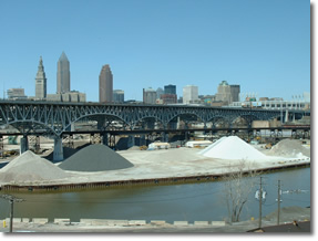
Like many cities that developed in the 19 th and early 20 th centuries, Cleveland grew because of its proximity to good transportation routes: in Cleveland’s case, its location at the conjunction of two navigable waterways, Lake Erie and the Ohio & Erie Canal. The construction of a number of railroad lines in the mid-1800s accelerated Cleveland’s growth. Without these transportation routes, neither raw materials nor prospective new residents could easily have reached Cleveland from outside the region, nor could things produced in the Cleveland area have been shipped to remote markets.
As the city expanded in area, economic activity, and population, its transportation infrastructure was under pressure to keep pace. As a result, much of the infrastructure that remains in place today was built between the late-1800s and the mid-1900s. During that period, industrial and commercial establishments shipped and received goods via the numerous railroads that served the city or by horse-drawn wagon; people moved on foot or by electric trolley. Indeed, much of the city’s development occurred with the conveniences of freight railroads and streetcar routes in mind. These arteries, after all, carried the lifeblood of the city—the one, raw materials and manufactured products; the other, workers and customers—and did so with singular efficiency. Purveyors of goods and services, naturally, wanted to be located along the streetcar routes; industries, along the railroad right-of-ways; and working families, within walking distance of those jobs.
Enter the internal combustion engine. By the mid-20 th century, a large portion of the goods produced in Cleveland were being moved by truck; people, by auto or public transit; and portions of the freight and intra-city passenger rail system were being dismantled. A superior network of local and regional roadways, bridges and rapid transit facilities, as well as Interstate highways, were planned and developed. In the latter part of the century—as non-motorized forms of transportation became increasingly popular—a network of multi-purpose trails, bicycle lanes, and other bike/pedestrian facilities were developed; others are now in the planning stages.
All of these resources, plus its commercial airports and water port facilities, have given Cleveland a sound base of transportation infrastructure on which to build in the 21 st century. Key improvements to this base, including expansion where necessary, and maintenance of the entire system will likely be the thrust of transportation infrastructure investments in the coming decades.
Next Page:Transportation and Transit:Assets |