|
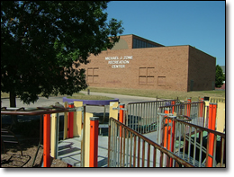
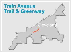
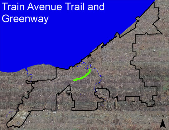
The Train Avenue Greenway Plan, which was completed in May 2008, examined the feasibility of developing a multi-purpose trail along the Train Avenue corridor to link the Michael Zone Recreation Center at Lorain Avenue and West 65th Street with the Towpath Trail in the vicinity of the Scranton Avenue-University Avenue intersection. The study, which was funded by a NOACA Transportation for Livable Cities Initiative (TLCI) grant was a cooperative effort that included the City of Cleveland and a partnership comprised of five near west side non-profit groups – Stockyard Redevelopment Organization, Detroit-Shoreway Community Development Corporation, Ohio City Near West Development Corporation, Tremont West Development Corporation and the Ohio Canal Corridor.
The entire study can be accessed here (link to pdf, 31 MB)
**WARNING - This is a large file and may be slow to download on slower connections.
Train Avenue Presentation to the City Planning Commission
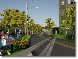
Among the study’s goals were to:
- Create an aesthetically pleasing greenway environment along this hitherto underutilized transportation corridor.
- Help re-establish Train Avenue as a major community asset.
- Promote alternatives to the automobile by providing a safe off-road route for pedestrians and bicyclists.
- Develop improved access to adjoining residential neighborhoods and community assets like parks, schools, libraries, and commercial areas.
- Create a regional recreational amenity centered on a multi-purpose trail plan that will provide connections to other trails identified in the City of Cleveland’s Bikeway Master Plan.
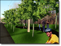
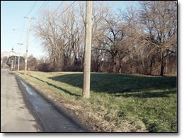
Before photo of central section of
greenway
The preferred route for the proposed 2.5-mile long neighborhood connector trail is along the Train Avenue right-of-way, immediately adjacent to yet separated from the roadway. This route was selected based on its construction feasibility, mainly the ability to use land within or immediately adjacent to the Train Avenue right-of-way, thereby minimizing the need for the expensive and time consuming acquisition of privately-owned land. The trail route runs through Walworth Run, a creek bed that was filled in the mid-1800s to accommodate a variety of freight railroad lines. Walworth Run and its surrounding environs are representative of Cleveland’s rich industrial and transportation history. Nearby are remnants of buildings that formerly housed breweries, metal fabricating companies and clothing manufacturers. The trail will commemorate this history along with the rich ethnic heritage of the people residing in the surrounding neighborhoods and the environmental changes that have been brought upon the Walworth Run ravine through the development of interpretive exhibits.
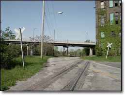
Before photo of Greenway Trail Head
The entire study can be accessed here (link to pdf, 31 MB)
**WARNING - This is a large file and may be slow to download on slower connections.
|