|
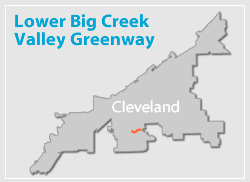
The Old Brooklyn Community Development Corporation, the City of Cleveland, Cleveland Metroparks and the Ohio Canal Corridor partnered to develop a comprehensive master plan and land use strategy for the Lower Big Creek Valley area. The resulting Lower Big Creek Greenway Redevelopment and Restoration Plan used as its base a variety of planning studies centered on the Valley that had previously been developed between the years 2000 to 2006 and concentrated on a variety of restoration, recreational and economic development concepts for this underutilized area. The Plan builds on these previous efforts by blending the best concepts of each previous study with new ideas developed by the planning team to create a new vision for a Valley Greenway. This new vision incorporates recommendations for future land uses, public access, infrastructure, ecological restoration and environmental regeneration, open space and trail linkages and economic development.
The entire study can be accessed here (PDF):
Lower Big Creek Valley presentation to the City Planning Commission
**WARNING - This is a large file and may be slow to download on slower connections.
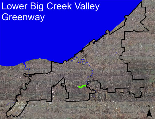
A major feature of the Plan was the assessment of the feasibility of developing a direct multi-purpose trail connection through the valley to connect Brookside Reservation and the Cleveland Metroparks Zoo with the Towpath Trail’s Harvard Avenue trailhead. Central to this objective was the goal of providing connector trails to link the adjacent Brooklyn Centre and Old Brooklyn neighborhoods to the proposed Greenway and trail system. Two options for the main trail were explored. One route, the 4.6-mile Upland Trail followed the southern valley rim from Brookside Reservation to the Harvard Avenue trailhead. The second option, the Valley Trail makes use of the Valley floor for most of its length. In so doing, it provides a number of options for linkages with neighborhood connector trails that link to parks and commercial nodes in both the Old Brooklyn and Brooklyn Centre neighborhoods. Based on an objective list of criteria, the two routes were analyzed and both were deemed feasible. However, it was determined that the Valley Route was the priority option that should be pursued in the near term.
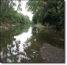
Big Creek at its Confluence
with the Cuyahoga River.
In addition to its trail component, the Plan included plans and strategies for greening the Valley, relocating incompatible land uses, re-programming underutilized properties like landfills, junkyards and outdoor storage sites by incorporating environmental regeneration and ecological restoration measures, and developing active and passive recreational uses like active sports and urban camping to draw people to the revitalized Valley.
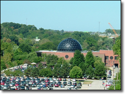 The Metroparks’ Zoo and Rainforest are in the Big Creek Valley
|